SEVERE THUNDERSTORM & EF2-EF5 TORNADO RISK 3/19/2025
STATES INCLUDE ILLIONIS, INDIANA, WESTERN OHIO, NORTHWEST KENTUCKY
Today, a powerful fast-moving storm system is moving out of the Central Plains and toward the Great Lakes, accompanied by a cold front to the south.
The storm system proved to be stronger than expected, and as a result, the National Weather Service’s Storm Prediction Center raised the risk level to “enhanced” in parts of Eastern Illinois and Western Indiana, while expanding the “slight” risk area to include much of Illinois, Indiana, Ohio and Kentucky.
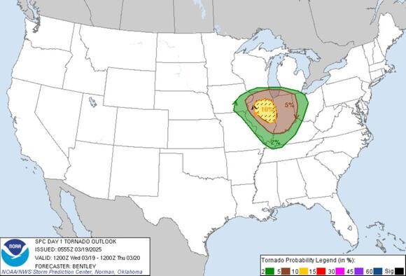

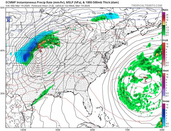
Photo bytropical tidbits
The European model shows the track of a developing low in Northwest Missouri that heads to the Great Lakes tonight and Thursday. West of the low track we have heavy snow and blizzard conditions from Northwest Iowa to northwest Wisconsin and the upper Peninsula of Michigan.
East and south of the low is where the warm sector lies and in this zone which extends south into Tennessee Mississippi & Alambama we have a marginal risk for isolated severe thunderstorms.
This storm system is not expected to produce a widespread severe weathter and tornado outbreak like we saw this past weekend in the Midwest & Deep South. Thunderstorm risk will shift eastward Thursday to parts of the Mid Atlantic but severe weather is not forecast at this time.